The French and Indian War was over, and in 1761 the valleys of western Vermont were temporarily at peace. They seemed to offer promise of a new and good life to those tired of the more populous parts of New England and of a profitable investment to others who did not choose, themselves, to face the wooded wilds. Thus, with mixed motives, a group of citizens from Salisbury, Connecticut, applied to Governor Benning Wentworth of New Hampshire for land in the newly opened New Hampshire Grants. In November, 1761, they were granted charters for four towns — Salisbury and Middlebury on November second, New Haven and Cornwall on November third.
Middlebury, purportedly so-named because it was between Salisbury on the south and New Haven on the north, was approximately six miles square. To the east were the Green Mountains. To the west was Otter Creek. In its northwest corner were the falls on the creek and the prominence later to be known as Chipman Hill. In its southern portion the Middlebury River meandered from mountains to creek. And in the middle, in the neighborhood of the present Case, Munger, and Foote Streets, was a large, relatively level tract of land. It was here that the original one-hundred-acre homelots of the proprietors of the new town were plotted in two tiers running on a slight diagonal across the town from north to south. In the center of this area a one-hundred-acre church lot was set aside and an adjacent two-hundred-acre town plot was reserved, to be divided into one-acre house sites. This was the area originally intended for the development of the village. It was settled slowly and not precisely according to the original survey. Some one thousand acres of the land in the area would be claimed beginning in 1784 by the vigorous sixty-year-old Daniel Foot and his five grown sons and married daughter. Under Foot’s determined leadership, it would remain an active contender until the turn of the century for the honor of being the town center, though in the end neither village nor church would 4 be located near this geographic center of town.
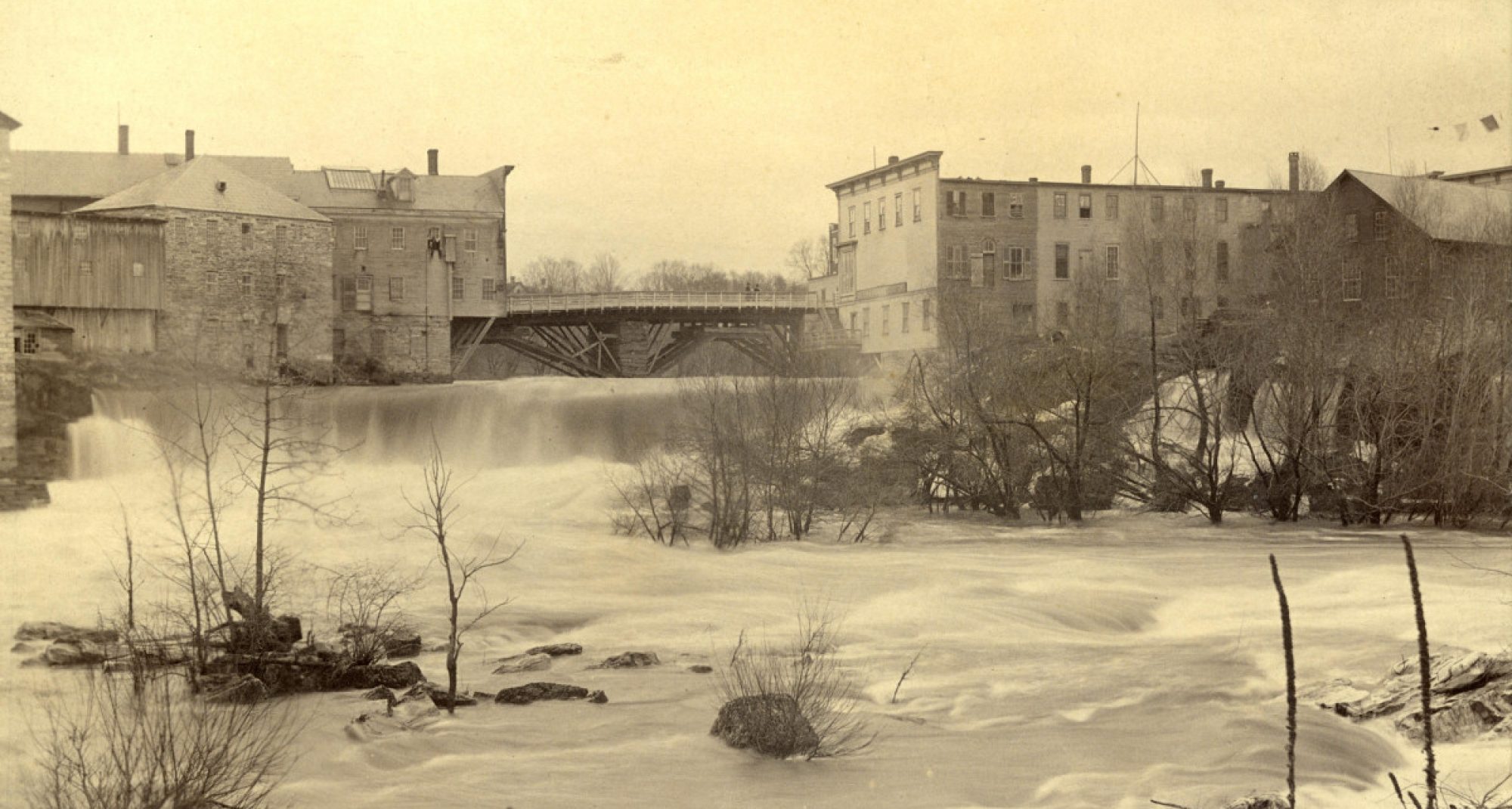
A second area for early development within the town was on the Middlebury River, near its confluence with Otter Creek. Here in 1766 John Chipman had arrived by boat, built a lean-to, and cleared the first land in Middlebury. Here, as well, in 1773 Chipman, his brother-in-law Gamaliel Painter, and townsman Benjamin Smalley and their families began the first permanent settlement in town. They quickly cleared land, planted their first crops, and built log cabins and barns. Of these buildings, only Chipman’s barn withstood the torches of raiding parties during the Revolution, its green logs refusing to catch fire. (It survived on the Seeley family farm until it was blown down in a storm in this century. A piece of the wood can be found in the Sheldon Museum. ) The owners of the buildings were swept up in the war, and their families abandoned Middlebury for safer points south.
It was not until 1783 that the settlers began to return to and rebuild their abandoned farms and homes. The Painters and Chipmans were back in 1784. Chipman soon built a fine brick house (burned in the 1830’s), which through his hospitality became a favorite local gathering place and the goal of the early town road along the east bank of the creek (known popularly in the nineteenth century as “Love Lane”). Painter’s prospects in 1784 looked equally bright. His buildings were rebuilt, his farm prospering, and his standing in the community on the rise. However, his future would be tied ultimately to the other end of Love Lane. In 1784 a general re-survey of the towns along the creek uncovered errors in the plotting of the original town lines and moved that of Salisbury northward. In the process Painter’s cabin and some one-hundred seventy of his two hundred acres proved actually to be on someone else’s claim. One of Middlebury’s leading citizens had become a mere squatter in Salisbury instead. The following April, Painter was given permission by his fellow townsmen to replace his lost land by claiming an equal area not previously assigned in Middlebury. However, the best farmland was already taken, the task of re-clearing was too disheartening, and Painter decided to change his course.
In 1774 on the east bank of Otter Creek at Middlebury Falls, Abisha Washburn (Chipman’s father-in-law) had built a sawmill which was subsequently destroyed during the Revolution. Painter joined Washburn in rebuilding the mill in 1784-1785 and claimed an adjoining fifty-acre mill lot for himself. When Washburn’s new mill was swept away in the spring freshet of 1786, Painter took over the mill business altogether along with Washburn’s fifty acres. He now owned one hundred acres adjacent to water power and at the convergence of area trails leading to the falls and the fording spot to Cornwall just upstream. Concurrently, in 1785 he was named a judge of the newly formed Addison County, and the next year became county sheriff. Agriculture now a thing of his past, Painter was ready to launch a new life as an industrialist, land speculator, and public figure and, in the process, to father Middlebury Village.